.
Image may be NSFW.
 Clik here to view.
Clik here to view.

View from UH-60 Black Hawk belonging to California Army National Guard 1-140th Aviation Battalion at the Rim Fire near Yosemite: photo by Master Sgt. Julie Avery, California National Guard, 22 August 2013 (US Air National Guard)
The fire is burning hotter and faster than any in modern Sierra Nevada history, firefighters say. Officials say it is the California wildfire they have warned about for years, as modern firefighting techniques have snuffed out forest fires, allowing fuel to build up on the mountain floor.
"This is it. This is the big one," Yosemite Fire Chief Kelly Martin said.
-- Los Angeles Times, 27 August 2013
The deer were bounding like blown leaves
Under the smoke in front of the roaring wave of the brushfire;
I thought of the smaller lives that were caught.
Beauty is not always lovely; the fire was beautiful, the terror
Of the deer was beautiful; and when I returned
Down the black slopes after the fire had gone by, an eagle
Was perched on the jag of a burnt pine,
Insolent and gorged, cloaked in the folded storms of his shoulders.
He had come from far off for the good hunting
With fire for his beater to drive the game; the sky was merciless
Blue, and the hills merciless black,
The sombre-feathered great bird sleepily merciless between them.
I thought, painfully, but the whole mind,
The destruction that brings an eagle from heaven is better than mercy.
Robinson Jeffers: Fire on the Hills, from Thurso's Landing, 1932
Clik here to view.

A road sign on California 120 near Groveland, scorched by the massive Rim fire used to read: "Caution: Snow Removal Not on Regular Basis." Tom Medema, a Yosemite National Park ranger said that "this fire is not going to stop until the snow flies.": photo by Don Bartletti, Los Angeles Times, 27 August 2013
Image may be NSFW.
Clik here to view.

Eagle, Vancouver, British Columbia: photo by Pierre, 21 July 2006
Odocoileus hemionus columbianus: Columbian Black-tailed Deer, Coast Deer female in fog: photo by Walter Siegmund, 2008
Image may be NSFW.
Clik here to view.
Mule Deer (Odocoileus hemionus), Inyo Crater Lakes, California: photo by Daniel Mayer, 2009
Image may be NSFW.
Clik here to view.
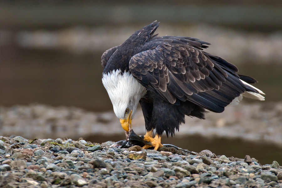
Bald Eagle, Harrison River, near Chilliwack, British Columbia: photo by Alan D. Wilson, 2011
Image may be NSFW.
Clik here to view.
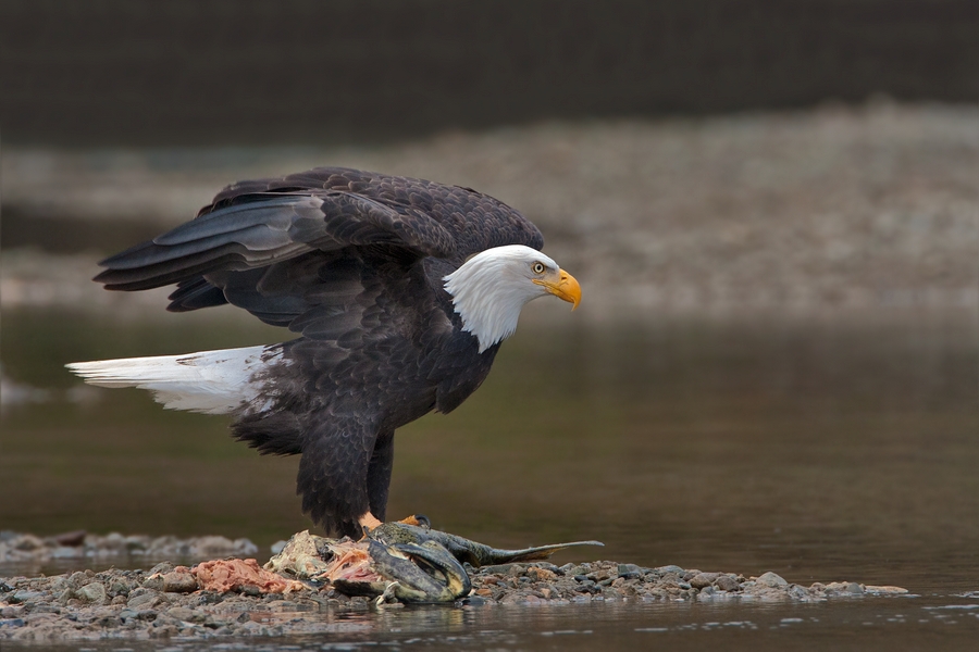
Bald Eagle, Harrison River, near Chilliwack, British Columbia: photo by Elaine R.Wilson, 2011
View by a member of Expedition 36 crew aboard the International Space Station of massive wildfires in and around California's Yosemite National Park: photo by NASA, 24 August 2013 (NASA)
Image may be NSFW.
Clik here to view.
The Rim Fire in the Stanislaus National Forest near in California began on Aug. 17, 2013 and is under investigation. The fire has consumed approximately 149, 780 acres and is 15% contained. The fire is burning at historic heat levels and speed: photo by U.S. Forest Service, 17 August 2013 (U.S. Department of Agriculture)
Clik here to view.
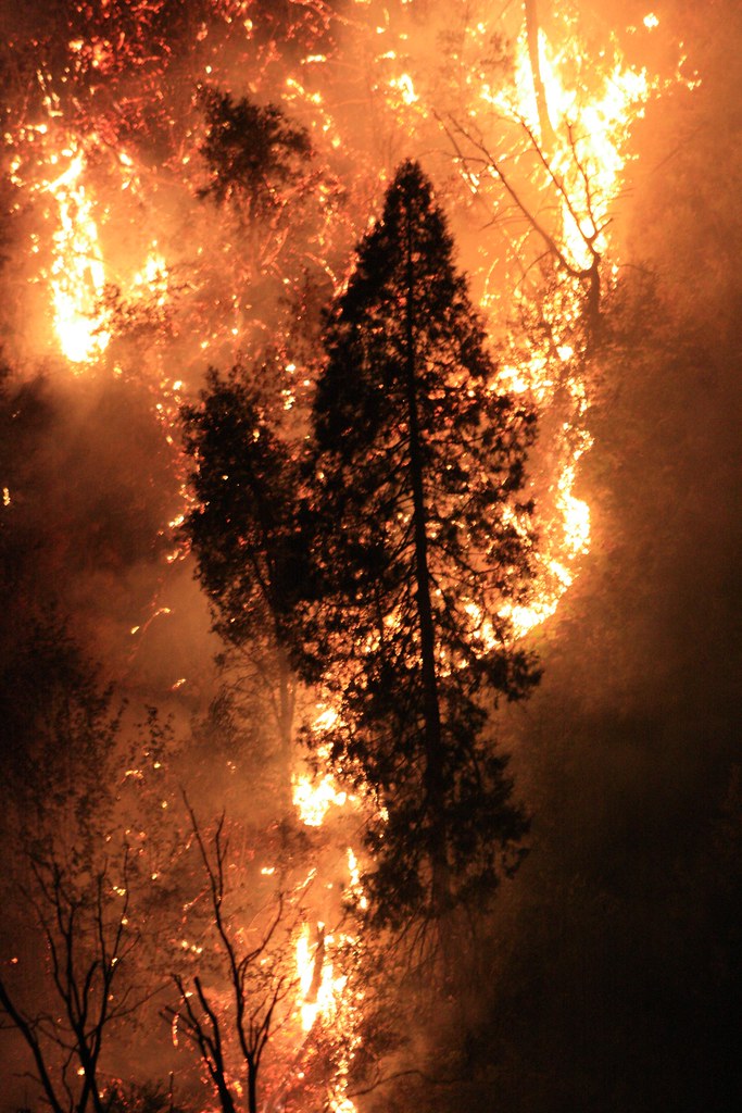
The Rim Fire in the Stanislaus National Forest near in California began on Aug. 17, 2013 and is under investigation. The fire has consumed approximately 149, 780 acres and is 15% contained. The fire is burning at historic heat levels and speed: photo by U.S. Forest Service, 17 August 2013 (U.S. Department of Agriculture)
Image may be NSFW.
Clik here to view.![]()
Clik here to view.
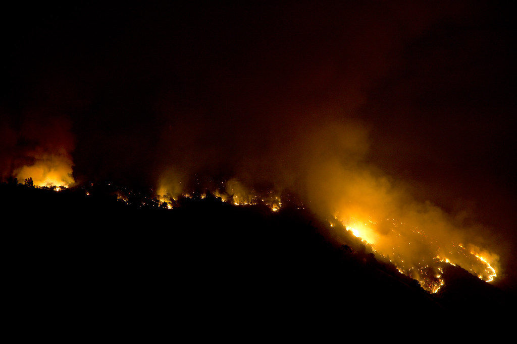
The Rim Fire along the Clavey River seen from south of the Tuolomne River: photo by Steve Ryan, 18 August 2013
Image may be NSFW.
Clik here to view.![]()
Clik here to view.

Rim Fire expands into Yosemite. The Rim Fire burning in the Stanislaus National Forest in California has crossed into Yosemite National Park. The fire has burned more than 105,000 acres, approximately 162 square miles, of brush, oak and pine trees in steep and marginally accessible terrain. This image was taken by the Suomi NPP satellite's Day-Night Band around 0950Z on August 23, 2013: photo by NASA Goddard Space Center, 26 August 2013 (NASA)
Image may be NSFW.
Clik here to view.
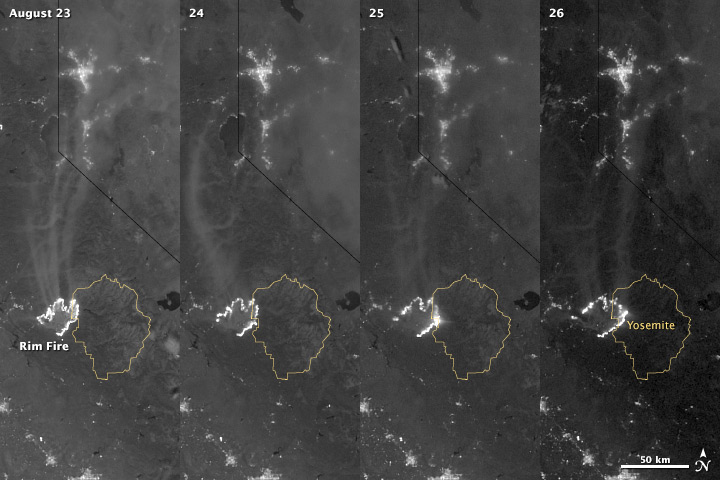
Nighttime views of advance of California's Rim Fire: image by NASA Goddard Space Center, 26 August 2013 (NASA Earth Observatory)
The winter of 2013 was among the driest on record for California, setting the stage for an active fire season. By August 26, the Rim Fire had made its way into the record books. At just 15 percent contained, the fire is now the 13th largest in California since records began in 1932. Apart from being large, the fire is also threatening one of the United States’ greatest natural treasures: Yosemite National Park.
The Visible Infrared Imaging Radiometer Suite (VIIRS) on the Suomi NPP satellite tracked the growth of the fire between August 23 and August 26 in this series of nighttime images. The VIIRS day-night band is extremely sensitive to low light, making it possible to see the fire front from space. The brightest, most intense parts of the fire glow white, exceeding the brightness of the lights of Reno, Nevada to the north. Pale gray smoke streams north away from the fire throughout the sequence.
The perimeter of the fire grows from day to day along different fronts, depending on winds and fire fighting efforts. On August 24, fire fighters focused their efforts on containing the western edge of the fire to prevent it from burning into Tuolumne City and the populated Highway 108 corridor. They also fought the eastern edge of the fire to protect Yosemite National Park. These efforts are evident in the image: Between August 23 and 24, the eastern edge of the fire held steady, and the western edge receded. The fire grew in the southeast.
On the morning of August 25 fire managers reported that the fire was growing in the north and east. In the image, the most intense activity is just inside Yosemite National Park.
Fire fighters reported that the Rim Fire continued to be extremely active on its eastern front on the morning of August 26, and this activity is visible in the image. By 8:00 a.m., the fire had burned 149,780 acres. The fire forced firefighters in Yosemite National Park to take measures to protect the Merced and Tuolumne Groves of Giant Sequoias, but the National Park Service reported that the trees were not in imminent danger. While parts of the park are closed, webcams show that most of the park has not been impacted.
The Rim Fire started on the afternoon of August 17. It has destroyed 23 structures and threatened 4,500 other buildings. Its cause is under investigation.
NASA Earth Observatory image by Jesse Allen and Robert Simmon, using VIIRS Day Night Band data. Caption by Holli Riebeek.Instrument: Suomi NPP - VIIRS
Image may be NSFW.
Clik here to view.![]()
Clik here to view.
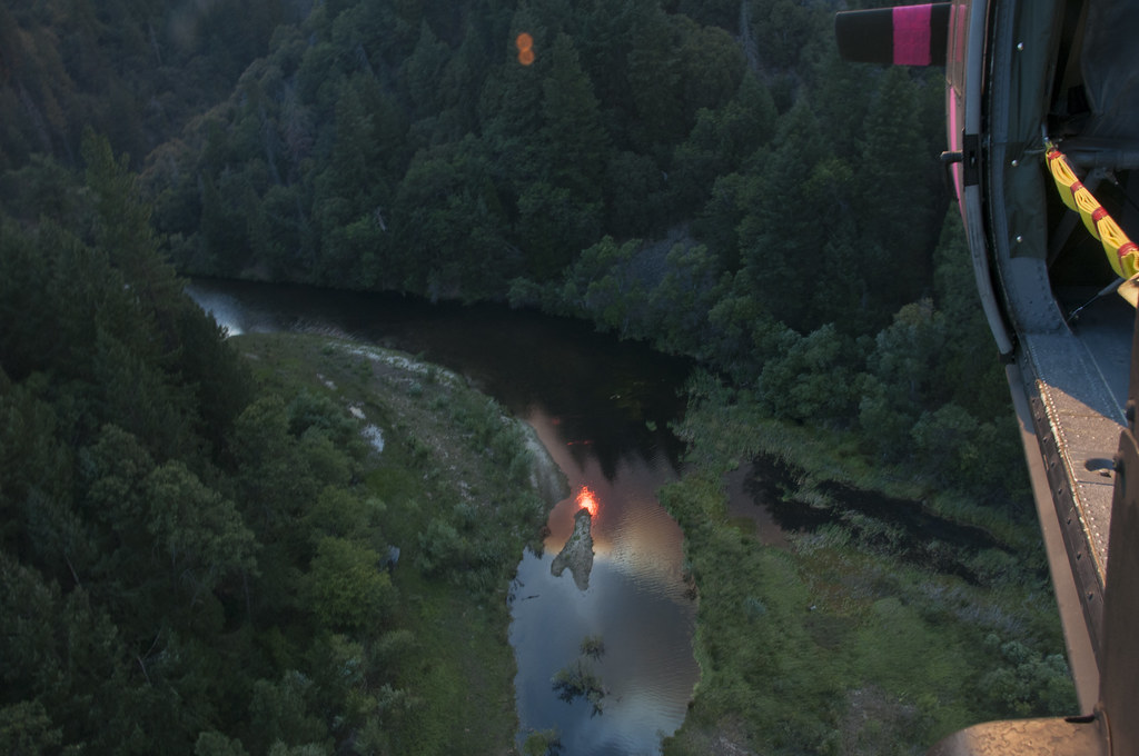
View from UH-60 Black Hawk belonging to California Army National Guard 1-140th Aviation Battalion at the Rim Fire near Yosemite: photo by Master Sgt. Julie Avery, California National Guard, 22 August 2013 (US Air National Guard)
Image may be NSFW.
Clik here to view.![]()
Clik here to view.
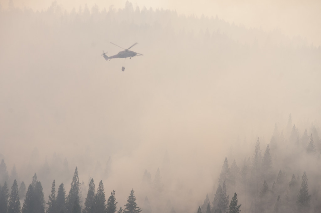
View from UH-60 Black Hawk belonging to California Army National Guard 1-140th Aviation Battalion at the Rim Fire near Yosemite: photo by Master Sgt. Julie Avery, California National Guard, 22 August 2013 (US Air National Guard)
Image may be NSFW.
Clik here to view.![]()
Clik here to view.
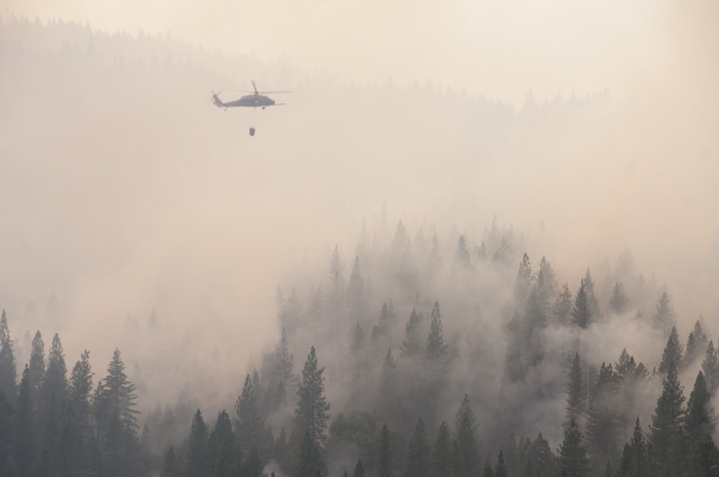
View from UH-60 Black Hawk belonging to California Army National Guard 1-140th Aviation Battalion at the Rim Fire near Yosemite: photo by Master Sgt. Julie Avery, California National Guard, 22 August 2013 (US Air National Guard)
Image may be NSFW.
Clik here to view.![]()
Clik here to view.
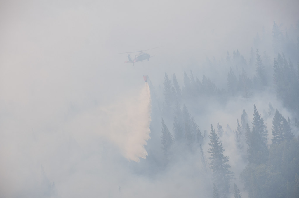
View from UH-60 Black Hawk belonging to California Army National Guard 1-140th Aviation Battalion at the Rim Fire near Yosemite: photo by Master Sgt. Julie Avery, California National Guard (US Air National Guard)
Image may be NSFW.
Clik here to view.![]()
Clik here to view.
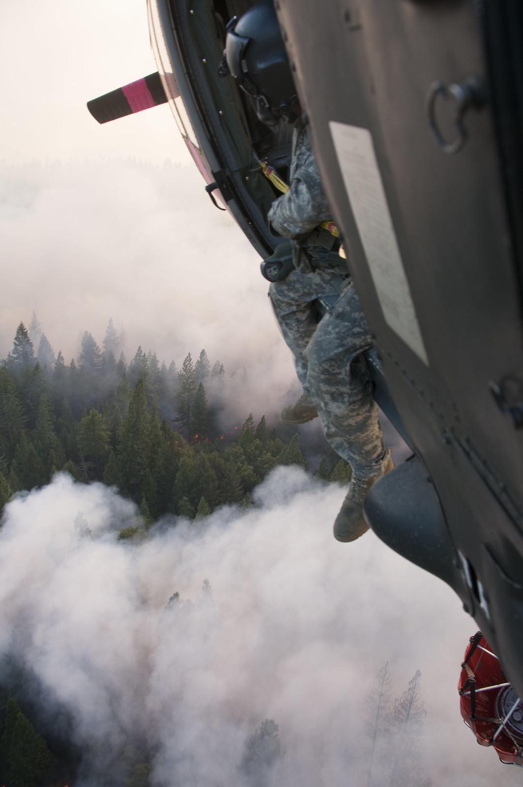
View from UH-60 Black Hawk belonging to California Army National Guard 1-140th Aviation Battalion at the Rim Fire near Yosemite: photo by Master Sgt. Julie Avery, California National Guard,22 August 2013 (US Air National Guard)
Image may be NSFW.
Clik here to view.![]()
Clik here to view.

View from UH-60 Black Hawk belonging to California Army National Guard 1-140th Aviation Battalion at the Rim Fire near Yosemite: photo by Master Sgt. Julie Avery, California National Guard, 22 August 2013 (US Air National Guard)
Image may be NSFW.
Clik here to view.![]()
Clik here to view.
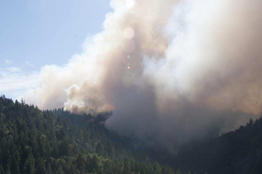
View from UH-60 Black Hawk belonging to California Army National Guard 1-140th Aviation Battalion at the Rim Fire near Yosemite: photo by Master Sgt. Julie Avery, California National Guard, 22 August 2013 (US Air National Guard)
Image may be NSFW.
Clik here to view.![]()
Clik here to view.
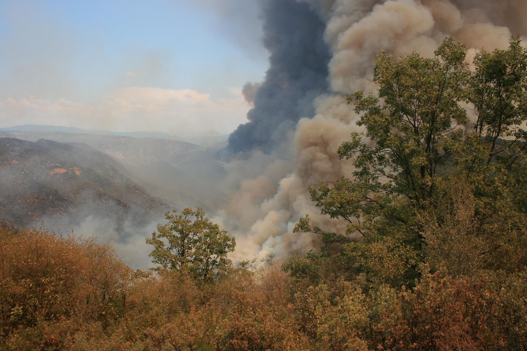
The Rim Fire in the Stanislaus National Forest near in California began on Aug. 17, 2013 and is under investigation. The fire has consumed approximately 149, 780 acres and is 15% contained: photo by U.S. Forest Service, 17 August 2013 (U.S. Department of Agriculture)
Image may be NSFW.
Clik here to view.![Rim fire by day]()
Clik here to view.

Rim Fire in the Yosemite area: image by NASA's Suomi NPP satellite, 25 August 2013 (NASA/NOAA)
Image may be NSFW.
Clik here to view.![]()
Clik here to view.
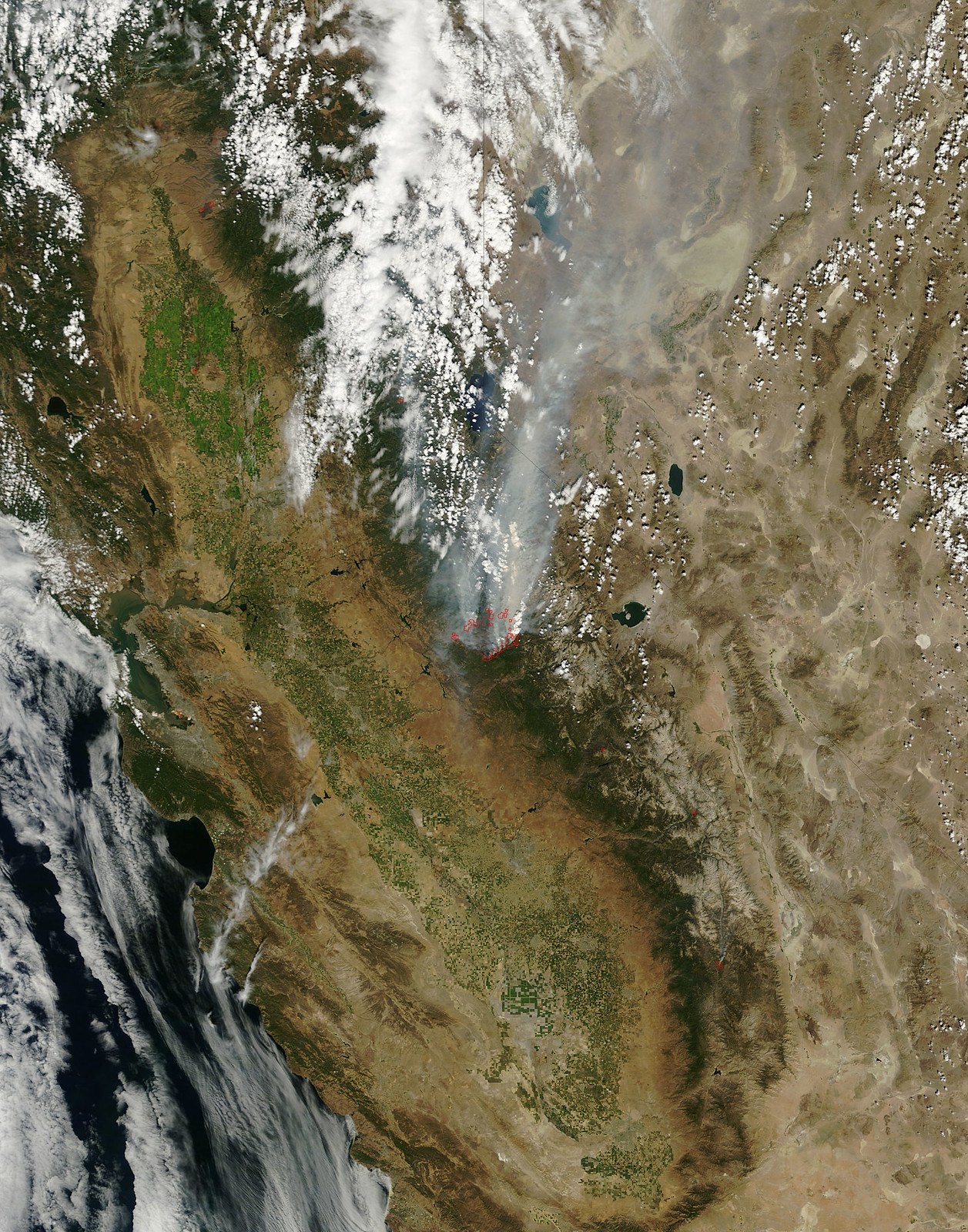
Satellite View of California Rim Fire: image by NASA Goddard Space Flight Center, 26 August 2013 (NASA Earth Observatory)
On August 25, 2013, the Moderate Resolution Imaging Spectroradiometer (MODIS) on NASA’s Terra satellite acquired this image of the drought-fueled Rim fire burning in central California, near Yosemite National Park. Red outlines indicate hot spots where MODIS detected unusually warm surface temperatures associated with fires. Winds blew a thick smoke plume toward the northeast. A smaller fire -- American Fire -- burned to the north.
NASA image by Jeff Schmaltz, LANCE/EOSDIS Rapid Response. Caption by Adam Voiland. Instrument: Terra - MODIS
Image may be NSFW.
Clik here to view.
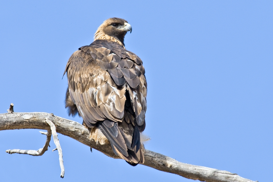
Golden Eagle, Horseshoe Bend, Bighorn Canyon National Recreation Area, near Lovell, Wyoming: photo by Alan D. Wilson, 2010
Image may be NSFW.
Clik here to view.

Mule Deer (Odocoileus hemionus), Araansas and Matagorda Island National Wildlife Refuge, near Hopper's Landing, Texas: photo by Alan D. Wilson, 2006


